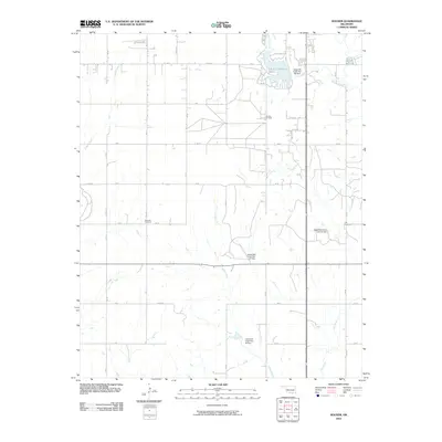
2010 Map of Hocker
USGS Topo · Published 2010About this map
The Elk City Oil Field dominates the central landscape of this Beckham County region, where industrial development and agricultural grids converge. Evidence of early settlement remains at the Bellview Cemetery and Ural Cemetery, standing as landmarks of local genealogy in a township defined by a network of rural roads such as BK K and n1977 RD.
Find a feature on this map
31 named features on this map. Tap any name to fly to it.
Don’t see what you’re looking for? This feature index may not catch every label — zoom into the map to look around manually.
Map Details
Editions of this 2010 Hocker Map
This is the sole edition of this map. No revisions or reprints were ever made.
Other maps of this area

1955 · Clinton
USGS Topo · 1:250,000

1957 · Clinton
USGS Topo · 1:250,000

1960 · Sayre
USGS Topo · 1:62,500

1961 · Willow
USGS Topo · 1:62,500

1961 · Retrop
USGS Topo · 1:62,500

1961 · Elk City
USGS Topo · 1:62,500

1985 · Elk City
USGS Topo · 1:100,000

1987 · Elk City
USGS Topo · 1:24,000
1987 · Hocker
USGS Topo · 1:24,000
1987 · Canute
USGS Topo · 1:24,000