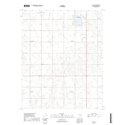
2018 Map of Hocker
USGS Topo · Published 2018About this map
Elk City and the surrounding plains of Beckham County are captured here in a period of modern expansion. The northern edge of the map shows the residential development of Merritt Mobile Home Park and the recreational waters of Lake Elk City, which serves as a central hub for the local geography. Moving south, the landscape transitions into the rural settlement of Hocker, situated along State Highway 152. This area is characterized by a sparse grid of section roads and the winding paths of Indian Creek, Sadler Creek, and West Elk Creek. For genealogists and local historians, the presence of Bellview Cem and Ural Cem provides essential points of reference for tracing family roots in this western Oklahoma prairie region.
Find a feature on this map
53 named features on this map. Tap any name to fly to it.
Don’t see what you’re looking for? This feature index may not catch every label — zoom into the map to look around manually.
Map Details
Editions of this 2018 Hocker Map
This is the sole edition of this map. No revisions or reprints were ever made.
Other maps of this area

1955 · Clinton
USGS Topo · 1:250,000

1957 · Clinton
USGS Topo · 1:250,000

1960 · Sayre
USGS Topo · 1:62,500

1961 · Willow
USGS Topo · 1:62,500

1961 · Retrop
USGS Topo · 1:62,500

1961 · Elk City
USGS Topo · 1:62,500

1985 · Elk City
USGS Topo · 1:100,000

1987 · Elk City
USGS Topo · 1:24,000
1987 · Hocker
USGS Topo · 1:24,000
1987 · Canute
USGS Topo · 1:24,000