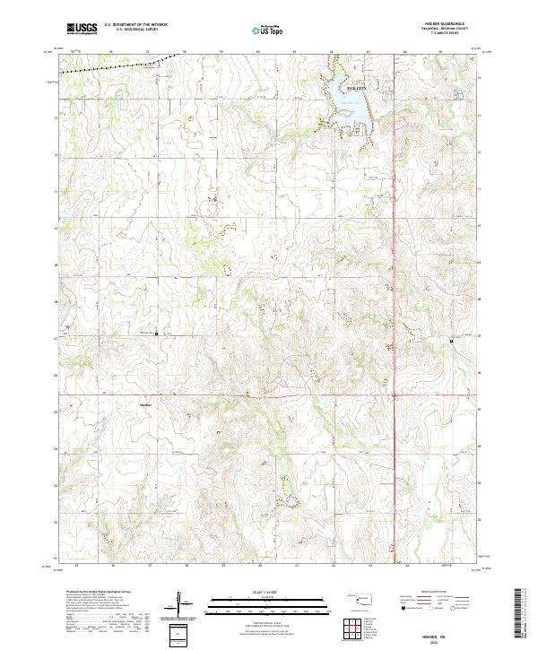
2022 Map of Hocker
USGS Topo · Published 2022About this map
Elk City and its immediate southern environs define the landscape of this Oklahoma survey, where the prairie begins to break into the drainage systems of the Washita River basin. The northern portion of the map is dominated by the reservoir of Lake Elk City, a focal point for the local geography fed by Elk Cr and W Elk Cr. To the south, the terrain becomes increasingly dissected by intermittent streams like Sadler Cr and Indian Cr, which cut through the red soil and rolling hills typical of Beckham County.
Find a feature on this map
37 named features on this map. Tap any name to fly to it.
Don’t see what you’re looking for? This feature index may not catch every label — zoom into the map to look around manually.
Map Details
Editions of this 2022 Hocker Map
This is the sole edition of this map. No revisions or reprints were ever made.
Other maps of this area

1955 · Clinton
USGS Topo · 1:250,000

1957 · Clinton
USGS Topo · 1:250,000

1960 · Sayre
USGS Topo · 1:62,500

1961 · Willow
USGS Topo · 1:62,500

1961 · Retrop
USGS Topo · 1:62,500

1961 · Elk City
USGS Topo · 1:62,500

1985 · Elk City
USGS Topo · 1:100,000

1987 · Elk City
USGS Topo · 1:24,000
1987 · Hocker
USGS Topo · 1:24,000
1987 · Canute
USGS Topo · 1:24,000