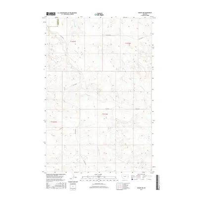
2017 Map of Hodges SW
USGS Topo · Published 2017About this map
Dawson and Wibaux county lines define the eastern edge of this eastern Montana landscape, where the high plains terrain is carved by the drainages of Eastman Cr, Wolf Cr, and the S Fork Horse Cr. The map reveals an area defined by the Public Land Survey System, with township and range lines overlaying a complex network of draws and ridges. Local agricultural and ranching infrastructure is evident through the inclusion of the Gibson Ditch, a man-made watercourse cutting through the center of the sheet. Transportation is dictated by the section-line grid and the contours of the land, featuring descriptive local routes such as Sand Creek Rd, Horse Creek Rd, and the evocative Bar Nothing Rd.
Find a feature on this map
15 named features on this map. Tap any name to fly to it.
Don’t see what you’re looking for? This feature index may not catch every label — zoom into the map to look around manually.
Map Details
Editions of this 2017 Hodges SW Map
This is the sole edition of this map. No revisions or reprints were ever made.
Other maps of this area

1953 · Miles City
USGS Topo · 1:250,000

1957 · Miles City
USGS Topo · 1:250,000

1958 · Miles City
USGS Topo · 1:250,000

1967 · Twin Forks Reservoir
USGS Topo · 1:24,000

1981 · Ayer Spring NE
USGS Topo · 1:24,000

1981 · Cap Rock
USGS Topo · 1:24,000

1981 · Rocking Chair Butte
USGS Topo · 1:24,000

1981 · Wibaux
USGS Topo · 1:100,000
1982 · Hodges SE
USGS Topo · 1:24,000

1982 · Hodges
USGS Topo · 1:24,000