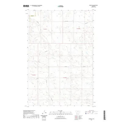
2020 Map of Hodges SW
USGS Topo · Published 2020About this map
Gibson Ditch cuts across this expansive section of Dawson County, highlighting the vital role of water management in eastern Montana's ranching landscape. This 2020 topographic survey traces a network of ephemeral drainages, including Eastman Cr and Wolf Cr, which defined the early boundaries of local land holdings and grazing allotments. The layout of the terrain is further delineated by established routes such as Sand Creek Rd and Horse Creek Rd, which provide access to the high plains between the Dawson and Wibaux county lines. The presence of S Fork Horse Cr and various wetlands indicates a landscape that, while sparse, is deeply connected to its hydrology. This map serves as a clear record of the modern rural infrastructure, where named tracks like Bar Nothing Dr lead to the isolated homesteads and pastures that characterize the region.
Find a feature on this map
14 named features on this map. Tap any name to fly to it.
Don’t see what you’re looking for? This feature index may not catch every label — zoom into the map to look around manually.
Map Details
Editions of this 2020 Hodges SW Map
This is the sole edition of this map. No revisions or reprints were ever made.
Other maps of this area

1953 · Miles City
USGS Topo · 1:250,000

1957 · Miles City
USGS Topo · 1:250,000

1958 · Miles City
USGS Topo · 1:250,000

1967 · Twin Forks Reservoir
USGS Topo · 1:24,000

1981 · Ayer Spring NE
USGS Topo · 1:24,000

1981 · Cap Rock
USGS Topo · 1:24,000

1981 · Rocking Chair Butte
USGS Topo · 1:24,000

1981 · Wibaux
USGS Topo · 1:100,000
1982 · Hodges SE
USGS Topo · 1:24,000

1982 · Hodges
USGS Topo · 1:24,000