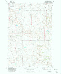
1982 Map of Hodges SW
USGS Topo · Published 1982About this map
Cedar Creek and Wolf Creek define the drainage patterns of this high plains landscape at the border of Dawson and Wibaux counties. In the early 1980s, the terrain shows a blend of natural watercourses and human infrastructure, notably the Gibson Ditch and a central Landing Strip. The presence of several Well sites and a crossing Pipeline indicates the region's involvement in resource extraction and energy transport during this era. Topography is marked by numerous draws and intermittent streams like Eastman Creek and Horse Creek, with localized features such as a Spring and a Substa illustrating the scattered nature of rural utility and water management. This survey provides a clear view of the land before modern agricultural and industrial expansion further altered the eastern Montana plains.
Find a feature on this map
11 named features on this map. Tap any name to fly to it.
Don’t see what you’re looking for? This feature index may not catch every label — zoom into the map to look around manually.
Map Details
Editions of this 1982 Hodges SW Map
This is the sole edition of this map. No revisions or reprints were ever made.
Other maps of this area

1953 · Miles City
USGS Topo · 1:250,000

1957 · Miles City
USGS Topo · 1:250,000

1958 · Miles City
USGS Topo · 1:250,000

1967 · Twin Forks Reservoir
USGS Topo · 1:24,000

1981 · Ayer Spring NE
USGS Topo · 1:24,000

1981 · Cap Rock
USGS Topo · 1:24,000

1981 · Rocking Chair Butte
USGS Topo · 1:24,000

1981 · Wibaux
USGS Topo · 1:100,000
1982 · Hodges SE
USGS Topo · 1:24,000

1982 · Hodges
USGS Topo · 1:24,000