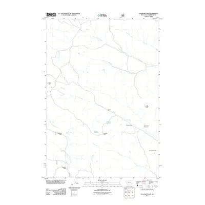
2011 Map of Hodsdon Flats
USGS Topo · Published 2011About this map
Hodsdon Flats and the surrounding drainage basins of Powder River County define this corner of Montana as it appeared in the early 21st century. The landscape is marked by a complex system of seasonal watercourses and man-made impoundments, including Gay Number 1 Dam and Gay Number 2 Dam, which support the region's agricultural and ranching needs. The terrain is characterized by numerous named gullies and coulees, such as Deadman Draw, Plum Coulee, and Sawmill Draw, which drain toward larger arterial creeks like Pinto Creek and Fire Creek. Geographic landmarks like Gardner Butte and Bailey Hill rise above the flats, providing navigational anchors in a territory largely defined by its intricate network of prongs and draws. Local transit relies on the unpaved corridor of Sonnette Rd, which winds through the western portion of the quadrangle near the headwaters of North Fork Bloom Creek.
Find a feature on this map
26 named features on this map. Tap any name to fly to it.
Don’t see what you’re looking for? This feature index may not catch every label — zoom into the map to look around manually.
Map Details
Editions of this 2011 Hodsdon Flats Map
This is the sole edition of this map. No revisions or reprints were ever made.
Other maps of this area

1954 · Ekalaka
USGS Topo · 1:250,000

1956 · Ekalaka
USGS Topo · 1:250,000

1958 · Ekalaka
USGS Topo · 1:250,000

1965 · Ekalaka
USGS Topo · 1:250,000

1966 · Sonnette
USGS Topo · 1:24,000

1966 · Phillips Butte
USGS Topo · 1:24,000

1966 · Hodsdon Flats
USGS Topo · 1:24,000

1966 · Threemile Buttes
USGS Topo · 1:24,000

1970 · Bloom Creek
USGS Topo · 1:24,000

1970 · Huckins School
USGS Topo · 1:24,000