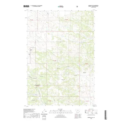
2020 Map of Hodsdon Flats
USGS Topo · Published 2020About this map
Custer National Forest lands dominate this part of Powder River County, revealing a landscape defined by an intricate network of intermittent drainages and high points like Gardner Butte and Bailey Hill. The settlement at Hodsdon Flats sits near the center of the sheet, surrounded by several essential water sources including Gallaway Reservoir and Turtle Reservoir. The drainage patterns here are complex, with waters flowing through named features such as Salt Cr, N Fork Cache Cr, and Pinto Cr, often carved into deep draws and gulches like Fire Gulch and Schwind Draw. Local road access is provided by Sonnette Rd in the western reaches. The map identifies numerous isolated water points critical to this environment, such as Harper Spring, Mason Spring, and Fence Corner Spring, illustrating the reliance on distributed water resources across these high plains.
Find a feature on this map
37 named features on this map. Tap any name to fly to it.
Don’t see what you’re looking for? This feature index may not catch every label — zoom into the map to look around manually.
Map Details
Editions of this 2020 Hodsdon Flats Map
This is the sole edition of this map. No revisions or reprints were ever made.
Other maps of this area

1954 · Ekalaka
USGS Topo · 1:250,000

1956 · Ekalaka
USGS Topo · 1:250,000

1958 · Ekalaka
USGS Topo · 1:250,000

1965 · Ekalaka
USGS Topo · 1:250,000

1966 · Sonnette
USGS Topo · 1:24,000

1966 · Phillips Butte
USGS Topo · 1:24,000

1966 · Hodsdon Flats
USGS Topo · 1:24,000

1966 · Threemile Buttes
USGS Topo · 1:24,000

1970 · Bloom Creek
USGS Topo · 1:24,000

1970 · Huckins School
USGS Topo · 1:24,000