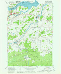
1964 Map of Hogansburg
USGS Topo · Published 1980About this map
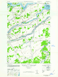
The St Regis Indian Reservation dominates the northern landscape of this survey, where the St Regis River and Raquette River flow toward their confluence with the St Lawrence River. The settlement of Hogansburg serves as a local hub near the reservation boundary, featuring the St Regis Ch and the Mohawk Memorial Cem. Further south, the legacy of early northern New York industry is visible at Brasher Iron Works and Ironton, situated along the Deer River amidst the sprawling St Lawrence State Forest. Transportation networks of the mid-1960s are clearly delineated, including the Massena-Cornwall International Bridge crossing into Canada and the rail corridors of the New York Central Railroad and Grand Trunk. The map documents a rural riverfront economy defined by international borders and the management of timber and water resources.
Find a feature on this map
56 named features on this map. Tap any name to fly to it.
Don’t see what you’re looking for? This feature index may not catch every label — zoom into the map to look around manually.
Map Details
Editions of this 1964 Hogansburg Map
3 editions found
Other maps of this area

1906 · Massena
USGS Topo · 1:62,500

1907 · Massena
USGS Topo · 1:62,500

1915 · Moira
USGS Topo · 1:62,500

1917 · Moira
USGS Topo · 1:62,500

1942 · Barnhart Island
USGS Topo · 1:24,000

1943 · Barnhart Island
USGS Topo · 1:31,680

1944 · Moira
USGS Topo · 1:62,500
1946 · Brasher Falls
USGS Topo · 1:24,000
1946 · Raquette River
USGS Topo · 1:24,000

1948 · Ogdensburg
USGS Topo · 1:250,000