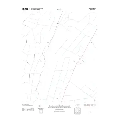
2013 Map of Hoke
USGS Topo · Published 2013About this map
Hoke and Beachgrove anchor this rural landscape in Washington County, defined by a network of drainage canals and lowland watercourses characteristic of the coastal plain. The topography is shaped by Acre Swamp in the south and Welch Cr to the north, with the No 2 Canal and Windley Canal Rd illustrating the managed hydrology of the region. The road network reveals the area's timber and transit history, evidenced by names like Morris Tram Rd, Long Ridge Rd, and Diamond City Rd. These corridors, alongside Cabin Swamp Rd and Barber Number 2 Rd, provide a window into the land divisions and family-named routes of the early 21st century.
Find a feature on this map
29 named features on this map. Tap any name to fly to it.
Don’t see what you’re looking for? This feature index may not catch every label — zoom into the map to look around manually.
Map Details
Editions of this 2013 Hoke Map
This is the sole edition of this map. No revisions or reprints were ever made.
Other maps of this area

1914 · Belhaven
USGS Topo · 1:48,000

1916 · Belhaven
USGS Topo · 1:62,500

1943 · Plymouth
USGS Topo · 1:125,000

1950 · Pinetown
USGS Topo · 1:24,000

1951 · Bunyan
USGS Topo · 1:24,000

1951 · Pantego
USGS Topo · 1:24,000

1953 · Rocky Mount
USGS Topo · 1:250,000

1954 · Rocky Mount
USGS Topo · 1:250,000

1954 · Plymouth East
USGS Topo · 1:24,000
1954 · Pike Road
USGS Topo · 1:24,000