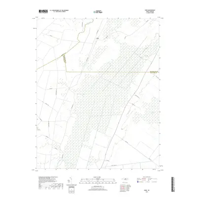
2019 Map of Hoke
USGS Topo · Published 2019About this map
Van Swamp and the East Dismal Swamp dominate this low-lying region of North Carolina, where the borders of Martin, Beaufort, and Washington Counties converge. The landscape is defined by its extensive wetlands and the drainage systems required to manage them, such as Acre Swamp and the No 2 Canal. The settlement of Hoke serves as a central point in this rural expanse, connected by a network of timber and farm roads named for local families and small communities. Researchers will find numerous private lanes like Latham Ln and Midgette Ln, alongside primary connectors like Long Ridge Rd. The presence of labels like Ange Town Rd and Baynor Town Ln hints at the genealogy of the area, marking where small family enclaves or defunct post offices once centered their activity amidst the surrounding marshlands.
Find a feature on this map
24 named features on this map. Tap any name to fly to it.
Don’t see what you’re looking for? This feature index may not catch every label — zoom into the map to look around manually.
Map Details
Editions of this 2019 Hoke Map
This is the sole edition of this map. No revisions or reprints were ever made.
Other maps of this area

1914 · Belhaven
USGS Topo · 1:48,000

1916 · Belhaven
USGS Topo · 1:62,500

1943 · Plymouth
USGS Topo · 1:125,000

1950 · Pinetown
USGS Topo · 1:24,000

1951 · Bunyan
USGS Topo · 1:24,000

1951 · Pantego
USGS Topo · 1:24,000

1953 · Rocky Mount
USGS Topo · 1:250,000

1954 · Rocky Mount
USGS Topo · 1:250,000

1954 · Plymouth East
USGS Topo · 1:24,000
1954 · Pike Road
USGS Topo · 1:24,000