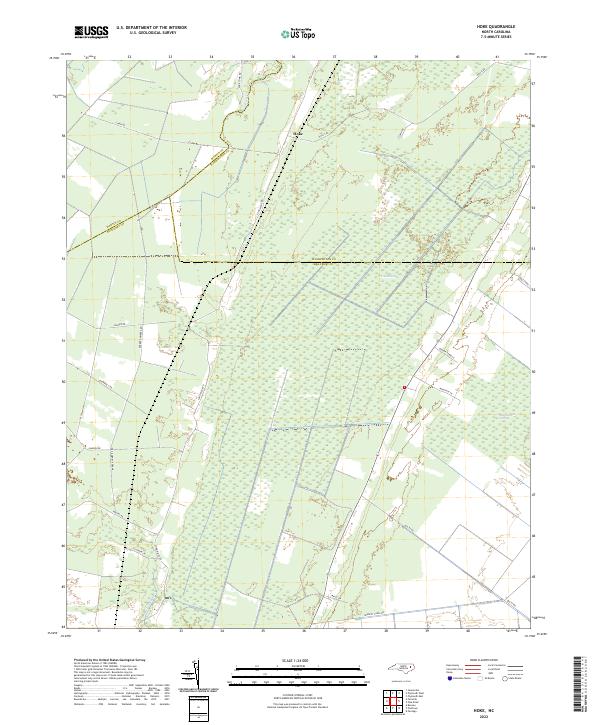
2022 Map of Hoke
USGS Topo · Published 2022About this map
Hoke sits at a low-lying crossroads where the borders of Beaufort, Martin, and Washington counties converge in eastern North Carolina. This coastal plain landscape is defined by vast wetland systems, most notably the East Dismal Swamp and Van Swamp, which are crisscrossed by drainage infrastructure like No 2 Canal and Windley Canal Rd. The map illustrates a rural settlement pattern where family-named thoroughfares such as Ange Town Rd, Baynor Town Ln, and Latham Ln serve isolated homesteads and agricultural tracts. Waterways like Mose Swamp and Welch Cr further delineate the saturated terrain, while the straight-line paths of Long Ridge Rd and Barber Number 2 Rd highlight the human effort to navigate and manage this complex hydrological environment.
Find a feature on this map
25 named features on this map. Tap any name to fly to it.
Don’t see what you’re looking for? This feature index may not catch every label — zoom into the map to look around manually.
Map Details
Editions of this 2022 Hoke Map
This is the sole edition of this map. No revisions or reprints were ever made.
Other maps of this area

1914 · Belhaven
USGS Topo · 1:48,000

1916 · Belhaven
USGS Topo · 1:62,500

1943 · Plymouth
USGS Topo · 1:125,000

1950 · Pinetown
USGS Topo · 1:24,000

1951 · Bunyan
USGS Topo · 1:24,000

1951 · Pantego
USGS Topo · 1:24,000

1953 · Rocky Mount
USGS Topo · 1:250,000

1954 · Rocky Mount
USGS Topo · 1:250,000

1954 · Plymouth East
USGS Topo · 1:24,000
1954 · Pike Road
USGS Topo · 1:24,000