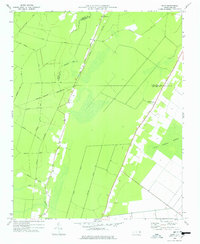
1978 Map of Hoke
USGS Topo · Published 1978About this map
The lowlands of Beaufort and Washington Counties are defined by a network of drainage and transport in this late 1970s survey. The small settlement of Hoke serves as a primary point of reference, situated where the Norfolk Southern rail line cuts through the landscape. This area is characterized by its significant wetlands, including the expansive East Dismal Swamp and Cabin Swamp, which dictate the placement of roads and human activity.
Find a feature on this map
25 named features on this map. Tap any name to fly to it.
Don’t see what you’re looking for? This feature index may not catch every label — zoom into the map to look around manually.
Map Details
Editions of this 1978 Hoke Map
This is the sole edition of this map. No revisions or reprints were ever made.
Other maps of this area

1914 · Belhaven
USGS Topo · 1:48,000

1916 · Belhaven
USGS Topo · 1:62,500

1943 · Plymouth
USGS Topo · 1:125,000

1950 · Pinetown
USGS Topo · 1:24,000

1951 · Bunyan
USGS Topo · 1:24,000

1951 · Pantego
USGS Topo · 1:24,000

1953 · Rocky Mount
USGS Topo · 1:250,000

1954 · Rocky Mount
USGS Topo · 1:250,000

1954 · Plymouth East
USGS Topo · 1:24,000
1954 · Pike Road
USGS Topo · 1:24,000