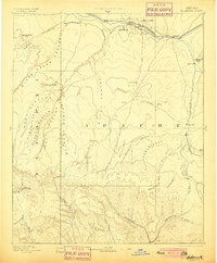
1893 Map of Holbrook
USGS Topo · Published 1900About this map
Holbrook serves as a vital rail hub in the high desert of the Arizona Territory, situated at the junction of the Atlantic and Pacific Railroad and the Little Colorado River. This late nineteenth-century reconnaissance survey captures a landscape of Mormon pioneer settlements and expansive livestock ranges before the modern dividing of counties. To the south, the terrain climbs toward the Mogollon Rim, revealing a network of irrigation-dependent towns like Snowflake, Taylor, and Showlow along Silver Creek. The map documents early water management efforts through features such as Beaver Tank and Porters Tank, essential for survival in the arid canyon country. Notable landmarks like Chevlon Butte and the Pink Cliffs provide orientation across the vast Apache and Yavapai lands, while the deep incisions of Chevlon Canyon and Wild Cat Canyon mark the transition toward the southern highlands.
Find a feature on this map
57 named features on this map. Tap any name to fly to it.
Don’t see what you’re looking for? This feature index may not catch every label — zoom into the map to look around manually.
Map Details
Editions of this 1893 Holbrook Map
4 editions found

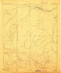
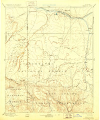
Other maps of this area

1883 · Tusayan
USGS Topo · 1:250,000

1886 · St Johns
USGS Topo · 1:250,000

1886 · Tusayan
USGS Topo · 1:250,000

1886 · Fort Defiance
USGS Topo · 1:250,000

1886 · San Francisco Mtns
USGS Topo · 1:250,000

1886 · Holbrook
USGS Topo · 1:250,000

1887 · Verde
USGS Topo · 1:250,000

1891 · San Francisco Mtns
USGS Topo · 1:250,000

1892 · Verde
USGS Topo · 1:250,000

1892 · Fort Defiance
USGS Topo · 1:250,000