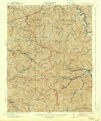
1928 Map of Holden
USGS Topo · Published 1943About this map
Mining and timber settlements dominate the landscape of Logan and Mingo Counties in this late 1920s survey. The Chesapeake and Ohio railroad follows the winding Guyandot River, connecting industrial hubs like Holden and Whitman to the larger coal network. A remarkable density of rural educational facilities, including the Upper Whitman School, Dempsey School, and Striker School, indicates a peak in local population before the mid-century shifts. The rugged terrain is carved by named waterways like Copperas Mine Fork and Pigeon Creek, which served as the primary conduits for settlement. Small stops and stations like Parsley Sta and Verdun Sta illustrate the vital role of rail transit in connecting these narrow hollows to larger towns like Chapmanville.
Find a feature on this map
110 named features on this map. Tap any name to fly to it.
Don’t see what you’re looking for? This feature index may not catch every label — zoom into the map to look around manually.
Map Details
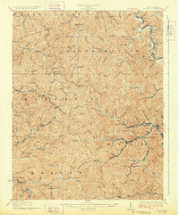
Editions of this 1928 Holden Map
2 editions found
Other maps of this area

1887 · Warfield
USGS Topo · 1:125,000

1891 · Oceana
USGS Topo · 1:125,000

1891 · Warfield
USGS Topo · 1:125,000

1892 · Huntington
USGS Topo · 1:125,000

1893 · Oceana
USGS Topo · 1:125,000

1898 · Huntington
USGS Topo · 1:125,000

1898 · Oceana
USGS Topo · 1:125,000

1899 · Charleston
USGS Topo · 1:125,000

1902 · Midkiff
USGS Topo · 1:62,500

1907 · Midkiff
USGS Topo · 1:62,500