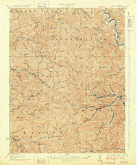
1928 Map of Holden
USGS Topo · Published 1928About this map
The Guyandot River winds through the northeastern portion of this Logan County terrain, anchoring a landscape defined by the intense confluence of coal mining and mountain topography. The Chesapeake and Ohio River RR follows the river's path, serving the shipping needs of riverside settlements like Chapmanville and Kitchen. Deep in the interior valleys, the rail infrastructure branches out into the hills, with lines reaching the Holden mining operations and Whitman Junction.
Find a feature on this map
104 named features on this map. Tap any name to fly to it.
Don’t see what you’re looking for? This feature index may not catch every label — zoom into the map to look around manually.
Map Details
Editions of this 1928 Holden Map
2 editions found
Other maps of this area

1887 · Warfield
USGS Topo · 1:125,000

1891 · Oceana
USGS Topo · 1:125,000

1891 · Warfield
USGS Topo · 1:125,000

1892 · Huntington
USGS Topo · 1:125,000

1893 · Oceana
USGS Topo · 1:125,000

1898 · Huntington
USGS Topo · 1:125,000

1898 · Oceana
USGS Topo · 1:125,000

1899 · Charleston
USGS Topo · 1:125,000

1902 · Midkiff
USGS Topo · 1:62,500

1907 · Midkiff
USGS Topo · 1:62,500