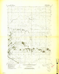
1981 Map of Holder
USGS Topo · Published 1981About this map
Kickapoo Creek and Money Creek carve through this central Illinois prairie landscape, defining the rural character of McLean County during the early 1980s. The area is anchored by small railway settlements and township clusters, including the community of Holder and the religious and social hub at Benjaminville, which features the Benjaminville Ch and Benjaminville Cem. The landscape is dominated by a grid of agricultural fields punctuated by local landmarks like Pleasant Grove Ch and the Lebo Cem.
Find a feature on this map
25 named features on this map. Tap any name to fly to it.
Don’t see what you’re looking for? This feature index may not catch every label — zoom into the map to look around manually.
Map Details
Editions of this 1981 Holder Map
2 editions found
Other maps of this area

1926 · Normal
USGS Topo · 1:62,500

1930 · Normal
USGS Topo · 1:62,500

1951 · Le Roy
USGS Topo · 1:62,500

1952 · Arrowsmith
USGS Topo · 1:62,500

1957 · Colfax
USGS Topo · 1:62,500

1958 · Peoria
USGS Topo · 1:250,000

1961 · Peoria
USGS Topo · 1:250,000

1963 · Peoria
USGS Topo · 1:250,000
1981 · Heyworth
USGS Topo · 1:24,000
1981 · Holder
USGS Topo · 1:24,000