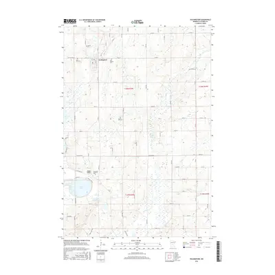
2016 Map of Holdingford
USGS Topo · Published 2016About this map
Holdingford sits at the heart of this central Minnesota landscape, where the S Two River winds through a terrain defined by glacial lakes and a strong heritage of parish settlements. To the south, the community of Saint Anna is located near the shores of Pelican Lake, anchored by the Immaculate Conception Cem. The map reveals a dense network of country roads, such as Saint Anna Dr and Two Rivers Rd, which connect various family-named landmarks and historical sites. Numerous cemeteries, including Highland Cem, Saint Marys Cem, and Sacred Heart Cem, are scattered across the townships, reflecting the deep-rooted local history of Stearns County. Water features are a primary characteristic of the area, ranging from the expansive Two River Lake to the smaller Little Pelican Lake and the meandering Spunk Cr in the eastern section of the quadrangle.
Find a feature on this map
49 named features on this map. Tap any name to fly to it.
Don’t see what you’re looking for? This feature index may not catch every label — zoom into the map to look around manually.
Map Details
Editions of this 2016 Holdingford Map
This is the sole edition of this map. No revisions or reprints were ever made.
Other maps of this area

1948 · Little Falls
USGS Topo · 1:62,500

1950 · Swanville
USGS Topo · 1:62,500

1950 · Little Falls
USGS Topo · 1:62,500

1953 · Saint Cloud
USGS Topo · 1:250,000

1957 · Saint Cloud
USGS Topo · 1:250,000

1958 · Saint Cloud
USGS Topo · 1:250,000

1965 · Albany
USGS Topo · 1:24,000

1965 · St Stephen
USGS Topo · 1:24,000

1965 · Farming
USGS Topo · 1:24,000

1965 · Holdingford
USGS Topo · 1:24,000