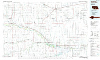
1986 Map of Holdrege
USGS Topo · Published 1986About this map
Phelps County Canal and the extensive irrigation network define this agricultural landscape during the mid-1980s. The region is characterized by a high concentration of conservation lands, including the Sacramento-Wilcox State Wildlife Management Area and various National Waterfowl Production Areas like Atlanta Marsh. The Republican River cuts through the southern portion of the sheet, feeding into the large expanse of Harlan County Lake near Alma. This waterway system, coupled with the Burlington Northern railroad lines connecting towns like Holdrege, Oxford, and Arapahoe, highlights the historical interdependence of rail transport and river-based resources. Genealogists may find interest in the Prairie Home Cem north of the river, while the transition from the Republican valley to the upland Elk Ridge provides a clear view of the diverse prairie terrain.
Find a feature on this map
82 named features on this map. Tap any name to fly to it.
Don’t see what you’re looking for? This feature index may not catch every label — zoom into the map to look around manually.
Map Details
Editions of this 1986 Holdrege Map
2 editions found
Other maps of this area

1893 · Smith Center
USGS Topo · 1:125,000

1893 · Norton
USGS Topo · 1:125,000

1893 · Phillipsburg
USGS Topo · 1:125,000

1894 · Kearney
USGS Topo · 1:62,500

1894 · Minden
USGS Topo · 1:62,500

1896 · Lexington
USGS Topo · 1:125,000

1896 · Holdrege
USGS Topo · 1:125,000

1896 · Kearney
USGS Topo · 1:125,000

1896 · Arapahoe
USGS Topo · 1:125,000

1896 · Wood River
USGS Topo · 1:125,000