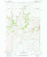
1965 Map of Hole-In-The-Rock
USGS Topo · Published 1980About this map
Hole-in-the-Rock serves as the namesake landmark for this transition between Garfield and Rosebud counties. The landscape is defined by its dramatic drainage patterns, where multiple unnamed waterfalls, simply labeled Falls, descend into the deep incisions of Big Porcupine Creek. To the east, the topography becomes even more convoluted through the sharp turns of Devils Canyon.
Find a feature on this map
11 named features on this map. Tap any name to fly to it.
Don’t see what you’re looking for? This feature index may not catch every label — zoom into the map to look around manually.
Map Details
Editions of this 1965 Hole-In-The-Rock Map
2 editions found
Other maps of this area

1954 · Forsyth
USGS Topo · 1:250,000

1957 · Forsyth
USGS Topo · 1:250,000

1958 · Forsyth
USGS Topo · 1:250,000

1960 · Hagen Ranch
USGS Topo · 1:24,000

1960 · Brown Coulee
USGS Topo · 1:24,000

1960 · Black Sea Reservoir
USGS Topo · 1:24,000

1965 · Acorn Flats
USGS Topo · 1:24,000

1965 · Kramer Ranch
USGS Topo · 1:24,000

1965 · Hole-In-The-Rock
USGS Topo · 1:24,000
1965 · Emma Butte
USGS Topo · 1:24,000