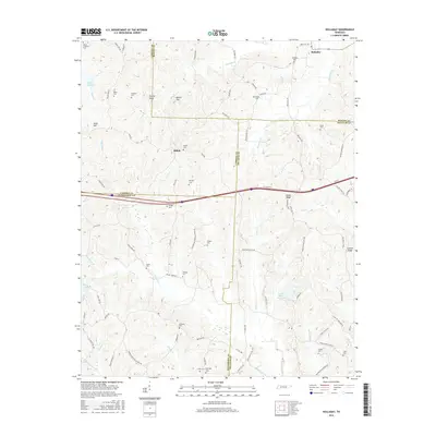
2016 Map of Holladay
USGS Topo · Published 2016About this map
Shiloh and Holladay serve as the primary hubs in this West Tennessee landscape, where the borders of Carroll, Benton, Decatur, and Henderson Counties converge. The region is defined by a high density of family and community burial grounds, including the Shiloh Cem, Holladay Cem, and Morgan Cem, suggesting a long-established rural settlement pattern tied to the land.
Find a feature on this map
96 named features on this map. Tap any name to fly to it.
Don’t see what you’re looking for? This feature index may not catch every label — zoom into the map to look around manually.
Map Details
Editions of this 2016 Holladay Map
This is the sole edition of this map. No revisions or reprints were ever made.
Other maps of this area

1936 · Yuma
USGS Topo · 1:24,000

1936 · Parsons
USGS Topo · 1:24,000

1936 · Seventeen Creek
USGS Topo · 1:24,000

1936 · Jeannette
USGS Topo · 1:24,000

1936 · Sugar Tree
USGS Topo · 1:24,000

1936 · Cavvia
USGS Topo · 1:24,000

1936 · Buena Vista
USGS Topo · 1:24,000

1936 · Rockport
USGS Topo · 1:24,000

1936 · Chesterfield
USGS Topo · 1:24,000
1949 · Jeannette
USGS Topo · 1:24,000