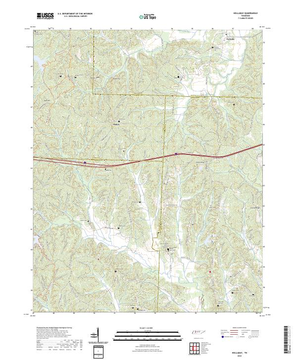
2022 Map of Holladay
USGS Topo · Published 2022About this map
The headwaters of Birdsong Cr and Cub Cr define this rural landscape on the border of Benton, Carroll, Decatur, and Henderson counties. The settlement of Holladay anchors the northeastern corner, surrounded by a high density of small family and community burial grounds that speak to generations of local settlement. Numerous cemeteries, including Holladay Community Cem, Ritter Cem, and Morgan Cem, are scattered across the ridges and hollows, often adjacent to old roads such as Shiloh RD and Taylor Town RD. The topography is marked by distinctive rises like Double Head and Round Top near the Carroll County line.
Find a feature on this map
102 named features on this map. Tap any name to fly to it.
Don’t see what you’re looking for? This feature index may not catch every label — zoom into the map to look around manually.
Map Details
Editions of this 2022 Holladay Map
This is the sole edition of this map. No revisions or reprints were ever made.
Other maps of this area

1936 · Yuma
USGS Topo · 1:24,000

1936 · Parsons
USGS Topo · 1:24,000

1936 · Seventeen Creek
USGS Topo · 1:24,000

1936 · Jeannette
USGS Topo · 1:24,000

1936 · Sugar Tree
USGS Topo · 1:24,000

1936 · Cavvia
USGS Topo · 1:24,000

1936 · Buena Vista
USGS Topo · 1:24,000

1936 · Rockport
USGS Topo · 1:24,000

1936 · Chesterfield
USGS Topo · 1:24,000
1949 · Jeannette
USGS Topo · 1:24,000