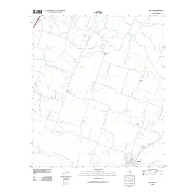
2010 Map of Holland
USGS Topo · Published 2010About this map
Holland anchors the southern portion of this Bell County landscape, appearing as a developed center at the junction of FM 2268 and FM 1123. The town is well-documented with local landmarks like the Holland Post Office, the City of Holland Water Tower, and the Holland Cemetery. To the north, the historic community of Sommers Mill sits along the banks of Salado Creek, a significant waterway that meanders through the central terrain.
Find a feature on this map
62 named features on this map. Tap any name to fly to it.
Don’t see what you’re looking for? This feature index may not catch every label — zoom into the map to look around manually.
Map Details
Editions of this 2010 Holland Map
This is the sole edition of this map. No revisions or reprints were ever made.
Other maps of this area

1885 · Taylor
USGS Topo · 1:125,000

1887 · Taylor
USGS Topo · 1:125,000

1892 · Temple
USGS Topo · 1:125,000

1893 · Georgetown
USGS Topo · 1:125,000

1894 · Gatesville
USGS Topo · 1:125,000

1894 · Taylor
USGS Topo · 1:125,000

1924 · Gatesville 4-d
USGS Topo · 1:48,000

1924 · Temple 3-C
USGS Topo · 1:48,000

1930 · Killeen
USGS Topo · 1:62,500

1931 · Belton
USGS Topo · 1:62,500