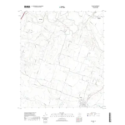
2019 Map of Holland
USGS Topo · Published 2019About this map
The Lampasas River and Leon River converge in the northern reaches of this Bell County landscape, forming the headwaters of the Little River. This 2019 survey documents a rural corridor defined by traditional agricultural properties and long-standing family landmarks. The settlement of Holland anchors the southern portion of the sheet, where researchers can identify the Holland Cem and several primary thoroughfares. To the north, the terrain rises toward Hartrick Bluff near Little River-Academy. Throughout the central hills, smaller watercourses like Runnells Cr and Cathey Cr bisect a network of farm-to-market roads, including FM 1123 and Summers Mill Rd. Genealogists will find particular value in the dispersed rural burial grounds such as Post Oak Cem, Bell Plains Cem, and Center Lake Cem, which speak to the early community nodes of this Central Texas region.
Find a feature on this map
83 named features on this map. Tap any name to fly to it.
Don’t see what you’re looking for? This feature index may not catch every label — zoom into the map to look around manually.
Map Details
Editions of this 2019 Holland Map
This is the sole edition of this map. No revisions or reprints were ever made.
Other maps of this area

1885 · Taylor
USGS Topo · 1:125,000

1887 · Taylor
USGS Topo · 1:125,000

1892 · Temple
USGS Topo · 1:125,000

1893 · Georgetown
USGS Topo · 1:125,000

1894 · Gatesville
USGS Topo · 1:125,000

1894 · Taylor
USGS Topo · 1:125,000

1924 · Gatesville 4-d
USGS Topo · 1:48,000

1924 · Temple 3-C
USGS Topo · 1:48,000

1930 · Killeen
USGS Topo · 1:62,500

1931 · Belton
USGS Topo · 1:62,500