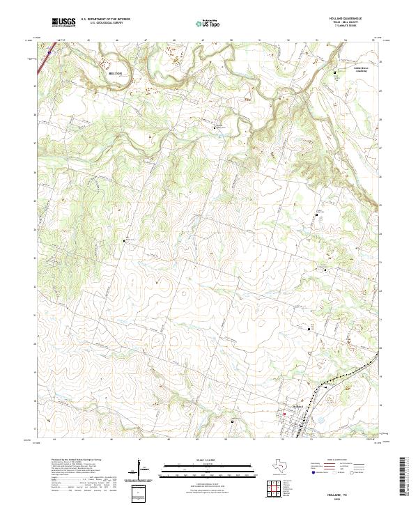
2022 Map of Holland
USGS Topo · Published 2022About this map
Holland and the surrounding Bell County ranchlands are defined by the convergence of several major central Texas waterways, including the Lampasas River, Little River, and Leon River. The landscape is etched by numerous tributaries such as Salado Creek, Cathey Cr, and Darrs Cr, which dictate the rural road patterns and settlement pockets. Genealogists will find a high density of small family and community burial sites scattered across the countryside, ranging from the Holland Family Cem near Summers Mill Rd to the Post Oak Cem and Cooks Chapel Cem further south. Near the northern boundary, the topography rises toward Hartrick Bluff Spr overlooking the river valley, while the town of Little River-Academy occupies the northeastern corner of the map. This era of the landscape is marked by a blend of long-established farm-to-market routes and newer residential developments branching off of Armstrong Rd and Elmer King Rd.
Find a feature on this map
92 named features on this map. Tap any name to fly to it.
Don’t see what you’re looking for? This feature index may not catch every label — zoom into the map to look around manually.
Map Details
Editions of this 2022 Holland Map
This is the sole edition of this map. No revisions or reprints were ever made.
Other maps of this area

1885 · Taylor
USGS Topo · 1:125,000

1887 · Taylor
USGS Topo · 1:125,000

1892 · Temple
USGS Topo · 1:125,000

1893 · Georgetown
USGS Topo · 1:125,000

1894 · Gatesville
USGS Topo · 1:125,000

1894 · Taylor
USGS Topo · 1:125,000

1924 · Gatesville 4-d
USGS Topo · 1:48,000

1924 · Temple 3-C
USGS Topo · 1:48,000

1930 · Killeen
USGS Topo · 1:62,500

1931 · Belton
USGS Topo · 1:62,500