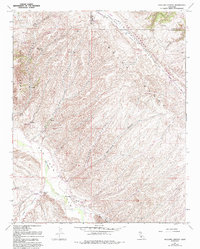
1961 Map of Holland Canyon
USGS Topo · Published 1993About this map
The San Andreas Rift Zone cuts a distinct northwest-to-southeast path across this portion of the Temblor Range, marking a geologically active boundary where the landscape is deeply scarred by tectonic movement. This 1961 survey, updated through the early 1990s, details a sparse ranching and watershed environment along the border of San Luis Obispo and Kern counties. Human activity is concentrated around Choice Valley, where the Choice Valley Sch and Bitterwater Road suggest a small, isolated rural community.
Find a feature on this map
26 named features on this map. Tap any name to fly to it.
Don’t see what you’re looking for? This feature index may not catch every label — zoom into the map to look around manually.
Map Details
Editions of this 1961 Holland Canyon Map
4 editions found
Other maps of this area

1914 · Cholame
USGS Topo · 1:125,000

1915 · Cholame
USGS Topo · 1:125,000

1917 · Cholame
USGS Topo · 1:125,000

1922 · Pozo
USGS Topo · 1:62,500

1932 · La Panza
USGS Topo · 1:48,000

1935 · La Panza
USGS Topo · 1:62,500

1936 · La Panza
USGS Topo · 1:62,500

1943 · Packwood
USGS Topo · 1:31,680

1943 · Grant Lake
USGS Topo · 1:31,680

1943 · Commatti Canyon
USGS Topo · 1:31,680