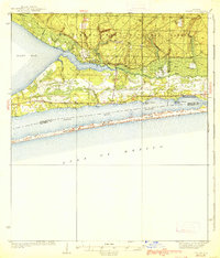
1938 Map of Holley
USGS Topo · Published 1938About this map
Choctawhatchee National Forest dominates the northern landscape of this Florida panhandle region, showing a transition from dense woodland and the East Bay Swamp to the maritime environments of the Gulf coast. In the mid-1930s, the settlement of Holley served as a small inland hub near the East Bay Ranger Station, while Navarre and Wynnehaven Beach began to take shape along the northern shore of the Santa Rosa Sound. The geography is defined by narrow waterways and coastal points like Miller Pt and Harper Pt, which lead into the protected waters of East Bay. South across the sound, the long, slender barrier of Santa Rosa Island stands between the sound and the open Gulf of Mexico, illustrating the natural coastal defenses of the era before significant modern development reached these shores.
Find a feature on this map
28 named features on this map. Tap any name to fly to it.
Don’t see what you’re looking for? This feature index may not catch every label — zoom into the map to look around manually.
Map Details
Editions of this 1938 Holley Map
3 editions found
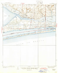
Other maps of this area

1920 · Milton
USGS Topo · 1:62,500

1921 · Holley
USGS Topo · 1:62,500

1921 · Pensacola
USGS Topo · 1:62,500

1934 · Holt
USGS Topo · 1:48,000

1934 · Harold
USGS Topo · 1:62,500

1936 · Holley
USGS Topo · 1:48,000

1937 · Holt
USGS Topo · 1:62,500

1937 · Harold
USGS Topo · 1:62,500

1938 · Mary Esther
USGS Topo · 1:62,500

1938 · Holley
USGS Topo · 1:62,500