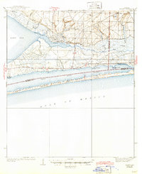
1938 Map of Holley
USGS Topo · Published 1946About this map
The coastal landscapes of Santa Rosa County are defined here by the long, narrow barrier of Santa Rosa Island, then protected under the Santa Rosa Island National Monument designation. North across the Santa Rosa Sound, the mainland shoreline is dotted with small coastal settlements such as Navarre, Wynnehaven Beach, and Woodlawn Beach. The interior is characterized by complex drainage systems, including the East Bay River and its various headwaters like Steep Head and West Head.
Find a feature on this map
38 named features on this map. Tap any name to fly to it.
Don’t see what you’re looking for? This feature index may not catch every label — zoom into the map to look around manually.
Map Details
Editions of this 1938 Holley Map
3 editions found
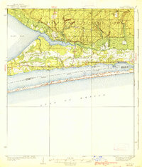
Other maps of this area

1920 · Milton
USGS Topo · 1:62,500

1921 · Holley
USGS Topo · 1:62,500

1921 · Pensacola
USGS Topo · 1:62,500

1934 · Holt
USGS Topo · 1:48,000

1934 · Harold
USGS Topo · 1:62,500

1936 · Holley
USGS Topo · 1:48,000

1937 · Holt
USGS Topo · 1:62,500

1937 · Harold
USGS Topo · 1:62,500

1938 · Mary Esther
USGS Topo · 1:62,500

1938 · Holley
USGS Topo · 1:62,500