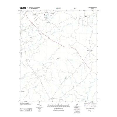
2011 Map of Hollins
USGS Topo · Published 2011About this map
Hollins and the surrounding Coosa County landscape are defined by a network of rural settlements and family-named landmarks situated along the ridge-and-valley terrain. Significant local history is preserved in a high density of cemeteries, including Macedonia Cemetery, Stewartville Cemetery, and Andrews Chapel Cemetery, which offer valuable data for genealogists. The area is characterized by drainage patterns moving through Weogufka Creek and Hatchet Creek, which have influenced the location of crossroad communities like Holman Crossroads and Stewartville. Transportation history is visible through named routes such as Old Plank Rd and Old Tramel Hwy, reflecting historical travel corridors. Minor infrastructure like Brown Dam on Lake Joy and the C W Gaston Dam indicate local water management, while the presence of Warm Springs and Overbrook suggests clusters of residential and recreational growth established by the early 21st century.
Find a feature on this map
71 named features on this map. Tap any name to fly to it.
Don’t see what you’re looking for? This feature index may not catch every label — zoom into the map to look around manually.
Map Details
Editions of this 2011 Hollins Map
This is the sole edition of this map. No revisions or reprints were ever made.
Other maps of this area

1890 · Talladega
USGS Topo · 1:125,000

1892 · Talladega
USGS Topo · 1:125,000

1901 · Wetumpka
USGS Topo · 1:125,000

1903 · Wetumpka
USGS Topo · 1:125,000

1915 · Gantts Quarry
USGS Topo · 1:48,000

1917 · Gantts Quarry
USGS Topo · 1:62,500

1944 · Goodwater
USGS Topo · 1:62,500

1947 · Goodwater
USGS Topo · 1:62,500

1953 · Montgomery
USGS Topo · 1:250,000

1953 · Birmingham
USGS Topo · 1:250,000