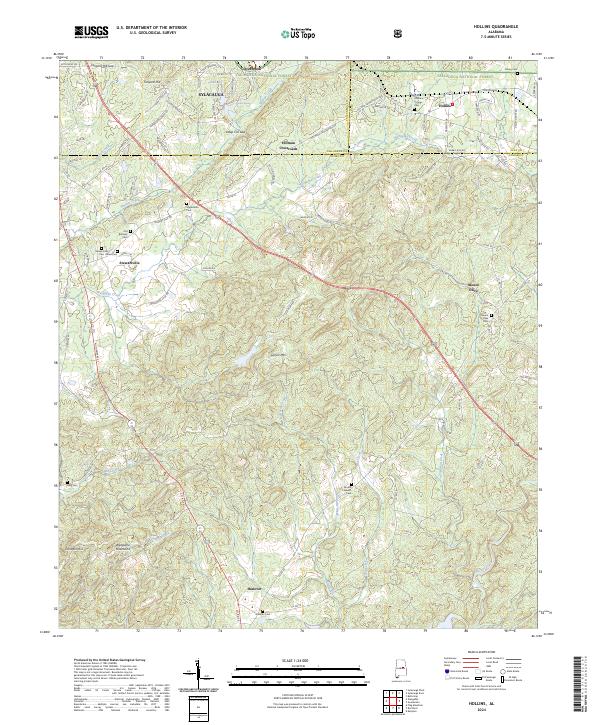
2024 Map of Hollins
USGS Topo · Published 2024About this map
Talladega National Forest dominates the northern reaches of this landscape, where the ridges of Locust Mtn and the Weogufka Mountains provide a backdrop for a series of rural communities. The map details a network of crossroad settlements including Hollins, Holman Crossroads, and Stewartville, each serving as a focal point for local transport and commerce. This high-elevation terrain is defined by its drainage patterns, with Hatchet Creek and Weogufka Creek carving valleys through the hills. For genealogists, the map is particularly useful for its identification of several legacy burial sites such as Macedonia Cem, Old Bethany Cem, and Mount Pleasant Cem. The presence of Tanyard Hill Gap and Deep Cut Gap illustrates the historical importance of mountain passes in connecting the southern Talladega highlands with the growing industrial center of Sylacauga to the northwest.
Find a feature on this map
94 named features on this map. Tap any name to fly to it.
Don’t see what you’re looking for? This feature index may not catch every label — zoom into the map to look around manually.
Map Details
Editions of this 2024 Hollins Map
This is the sole edition of this map. No revisions or reprints were ever made.
Other maps of this area

1890 · Talladega
USGS Topo · 1:125,000

1892 · Talladega
USGS Topo · 1:125,000

1901 · Wetumpka
USGS Topo · 1:125,000

1903 · Wetumpka
USGS Topo · 1:125,000

1915 · Gantts Quarry
USGS Topo · 1:48,000

1917 · Gantts Quarry
USGS Topo · 1:62,500

1944 · Goodwater
USGS Topo · 1:62,500

1947 · Goodwater
USGS Topo · 1:62,500

1953 · Montgomery
USGS Topo · 1:250,000

1953 · Birmingham
USGS Topo · 1:250,000