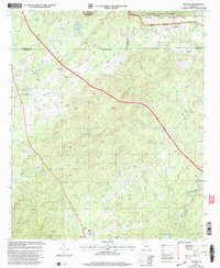
2001 Map of Hollins
USGS Topo · Published 2004About this map
Hollins anchors the northeastern corner of this Alabama landscape, where the Talladega National Forest and the Hollins Wildlife Management Area dominate the rolling topography. The region is defined by a dense network of waterways, including Hatchet Creek and the winding Shelton Creek, which carved the terrain long before modern infrastructure. Smaller rural settlements such as Hanover, Stewartville, and Holman Crossroads appear as vital community nodes connected by a mix of primary roads and unimproved trails. The map documents numerous landmarks essential for local history and genealogy, ranging from the Coosa Co Voc Center to traditional places of worship like Bethany Ch and Macedonia Ch. Distinctive land features such as Deep Cut Gap and Mt Olive rise above the stream valleys, illustrating the complex geography of the Talladega and Coosa County borderlands.
Find a feature on this map
31 named features on this map. Tap any name to fly to it.
Don’t see what you’re looking for? This feature index may not catch every label — zoom into the map to look around manually.
Map Details
Editions of this 2001 Hollins Map
This is the sole edition of this map. No revisions or reprints were ever made.
Other maps of this area

1890 · Talladega
USGS Topo · 1:125,000

1892 · Talladega
USGS Topo · 1:125,000

1901 · Wetumpka
USGS Topo · 1:125,000

1903 · Wetumpka
USGS Topo · 1:125,000

1915 · Gantts Quarry
USGS Topo · 1:48,000

1917 · Gantts Quarry
USGS Topo · 1:62,500

1944 · Goodwater
USGS Topo · 1:62,500

1947 · Goodwater
USGS Topo · 1:62,500

1953 · Montgomery
USGS Topo · 1:250,000

1953 · Birmingham
USGS Topo · 1:250,000