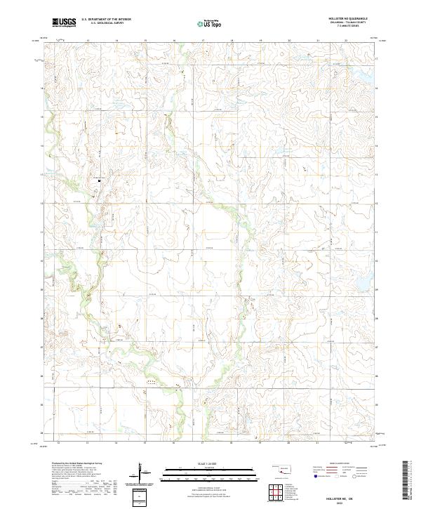
2022 Map of Hollister NE
USGS Topo · Published 2022About this map
Horse Cr and Deep Red Cr wind through this section of Tillman County, shaping a landscape defined by an extensive network of rural section-line roads and agricultural water management. The terrain is notably marked by numerous numbered water bodies, including 141013 Reservoir and 141018 Reservoir, which support the local farming economy across the townships of t1s r16w and t1s r15w. For those researching local history or family genealogy, Dickerson Cem provides a significant anchor point on the landscape between n2310 RD and n2320 RD. The grid-like precision of the local road system, including the intersecting e1780 RD and n2330 RD, illustrates the systematic development of Oklahoma's southwestern plains into the modern era.
Find a feature on this map
33 named features on this map. Tap any name to fly to it.
Don’t see what you’re looking for? This feature index may not catch every label — zoom into the map to look around manually.
Map Details
Editions of this 2022 Hollister NE Map
This is the sole edition of this map. No revisions or reprints were ever made.
Other maps of this area

1937 · Cache
USGS Topo · 1:48,000

1942 · Cache
USGS Topo · 1:62,500

1950 · Snyder
USGS Topo · 1:62,500

1955 · Lawton
USGS Topo · 1:250,000

1956 · Post Oak Creek
USGS Topo · 1:24,000

1956 · Manitou
USGS Topo · 1:24,000

1956 · Indiahoma
USGS Topo · 1:24,000
1956 · Cache
USGS Topo · 1:62,500

1956 · Snyder
USGS Topo · 1:62,500

1962 · Chattanooga
USGS Topo · 1:62,500