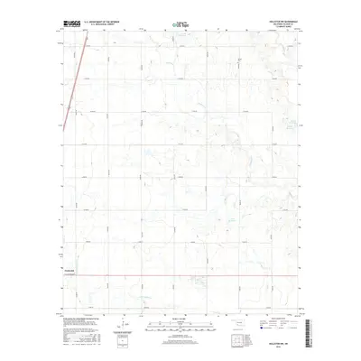
2016 Map of Hollister NW
USGS Topo · Published 2016About this map
Frederick stands at the southwestern edge of this Tillman County landscape, where the town’s grid meets an expansive network of sectional roads. The terrain is defined by the winding drainage systems of Deep Red Creek and Little Deep Red Creek, which carve subtle valleys across the plains. These watercourses are supplemented by several named catchment areas, including 141008 Reservoir and 141009 Reservoir, reflecting the agricultural and water management needs of the region.
Find a feature on this map
25 named features on this map. Tap any name to fly to it.
Don’t see what you’re looking for? This feature index may not catch every label — zoom into the map to look around manually.
Map Details
Editions of this 2016 Hollister NW Map
This is the sole edition of this map. No revisions or reprints were ever made.
Other maps of this area

1950 · Snyder
USGS Topo · 1:62,500

1955 · Lawton
USGS Topo · 1:250,000

1956 · Manitou
USGS Topo · 1:24,000

1956 · Indiahoma
USGS Topo · 1:24,000

1956 · Snyder
USGS Topo · 1:62,500

1958 · Frederick
USGS Topo · 1:62,500

1964 · Tipton SE
USGS Topo · 1:24,000

1974 · Hollister NW
USGS Topo · 1:24,000

1974 · Hackberry Flat
USGS Topo · 1:24,000
1974 · Hollister
USGS Topo · 1:24,000