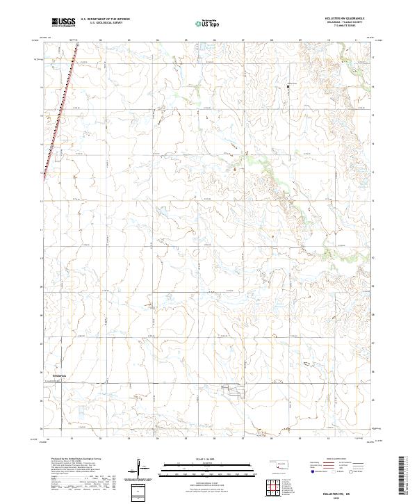
2022 Map of Hollister NW
USGS Topo · Published 2022About this map
Frederick sits at the southwestern corner of this Tillman County landscape, where the town grid meets the agricultural section lines of the Oklahoma prairie. The terrain is defined by the drainage systems of Deep Red Cr and Little Deep Red Cr, which meander through the southern portion of the quadrangle. To the north and east, the seasonal flow of Deadman Cr cuts through the plains, punctuated by several numbered reservoirs such as 141008 Reservoir and 141009 Reservoir. This 2022 survey illustrates a classic Southern Oklahoma rural layout, where the rectangular survey system dictates a precise network of roads like e1760 RD and n2240 RD. Bethel Cem, located in the northeastern quadrant, serves as a significant landmark for genealogists and local historians, representing the long-standing community roots established in this cattle and farming country long before modern irrigation projects changed the hydrology of the plains.
Find a feature on this map
30 named features on this map. Tap any name to fly to it.
Don’t see what you’re looking for? This feature index may not catch every label — zoom into the map to look around manually.
Map Details
Editions of this 2022 Hollister NW Map
This is the sole edition of this map. No revisions or reprints were ever made.
Other maps of this area

1950 · Snyder
USGS Topo · 1:62,500

1955 · Lawton
USGS Topo · 1:250,000

1956 · Manitou
USGS Topo · 1:24,000

1956 · Indiahoma
USGS Topo · 1:24,000

1956 · Snyder
USGS Topo · 1:62,500

1958 · Frederick
USGS Topo · 1:62,500

1964 · Tipton SE
USGS Topo · 1:24,000

1974 · Hollister NW
USGS Topo · 1:24,000

1974 · Hackberry Flat
USGS Topo · 1:24,000
1974 · Hollister
USGS Topo · 1:24,000