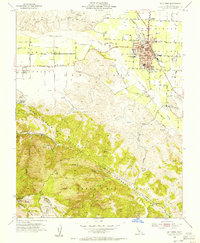
1955 Map of Hollister
USGS Topo · Published 1956About this map
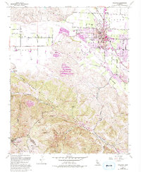
Hollister serves as the focal point of this mid-century survey, situated at the junction of the San Benito River and the agricultural San Juan Valley. The layout reveals a developing town center with civic landmarks such as the San Benito County H S and Jr College and the R O Hardin School, while the Southern Pacific tracks underscore the town's role as a regional transport hub. To the southwest, the dramatic topography of the Gabilan Range is bisected by the prominent San Andreas Rift Zone, where narrow canyons like San Juan Canyon and North Canyon cut through the landscape. This interface between the flat valley floor and the rift-defined mountains illustrates the geologically active nature of the region. Scattered throughout the rural fringes are numerous family-named landmarks and infrastructure, including the Landing Strip and Cottage Corners, reflecting the area's transition from open ranching to established rural settlements.
Find a feature on this map
57 named features on this map. Tap any name to fly to it.
Don’t see what you’re looking for? This feature index may not catch every label — zoom into the map to look around manually.
Map Details
Editions of this 1955 Hollister Map
5 editions found
Other maps of this area

1910 · Salinas
USGS Topo · 1:31,680

1912 · Salinas
USGS Topo · 1:62,500

1915 · San Juan Bautista
USGS Topo · 1:48,000

1917 · San Juan Bautista
USGS Topo · 1:62,500

1919 · Hollister
USGS Topo · 1:48,000

1921 · Gonzales
USGS Topo · 1:62,500

1921 · Hollister
USGS Topo · 1:62,500

1923 · Hollister
USGS Topo · 1:62,500

1939 · San Juan Bautista
USGS Topo · 1:62,500

1940 · San Juan Bautista
USGS Topo · 1:62,500