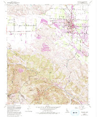
1955 Map of Hollister
USGS Topo · Published 1994About this map
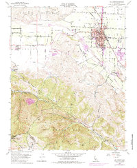
Hollister serves as the central hub of this mid-century survey, surrounded by the fertile expanse of the Hollister Valley and San Juan Valley. The town's layout is meticulously detailed, showing academic landmarks like the San Benito Joint Union High Sch and Fremont Sch, alongside medical facilities such as Hazel Hawkins Hospital. The landscape is dominated by the dramatic topography of the San Andreas Rift Zone, which carves through the Gabilan Range and Hollister Hills. Water management is evident through the San Justo Reservoir and the course of the San Benito River. To the south, the State Vehicular Recreation Area occupies the rugged terrain near Bird Creek and Cienega Creek, illustrating the region's shift toward public land management and recreational use within the complex geology of the rift zone.
Find a feature on this map
50 named features on this map. Tap any name to fly to it.
Don’t see what you’re looking for? This feature index may not catch every label — zoom into the map to look around manually.
Map Details
Editions of this 1955 Hollister Map
5 editions found
Other maps of this area

1910 · Salinas
USGS Topo · 1:31,680

1912 · Salinas
USGS Topo · 1:62,500

1915 · San Juan Bautista
USGS Topo · 1:48,000

1917 · San Juan Bautista
USGS Topo · 1:62,500

1919 · Hollister
USGS Topo · 1:48,000

1921 · Gonzales
USGS Topo · 1:62,500

1921 · Hollister
USGS Topo · 1:62,500

1923 · Hollister
USGS Topo · 1:62,500

1939 · San Juan Bautista
USGS Topo · 1:62,500

1940 · San Juan Bautista
USGS Topo · 1:62,500