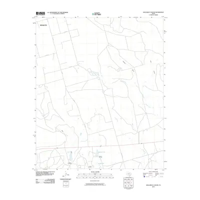
2010 Map of Holloway Canyon
USGS Topo · Published 2010About this map
Mesquite and the surrounding ranchlands of Borden County define this landscape, where water management is central to the local geography. The area is marked by numerous engineered water features such as Johnson Tank, Johnson Tank Dam, and the Coleman Lake Dam, reflecting the necessity of irrigation and livestock watering in West Texas. These man-made reservoirs sit alongside natural drainages like Mesquite Creek and Grape Creek.
Find a feature on this map
20 named features on this map. Tap any name to fly to it.
Don’t see what you’re looking for? This feature index may not catch every label — zoom into the map to look around manually.
Map Details
Editions of this 2010 Holloway Canyon Map
This is the sole edition of this map. No revisions or reprints were ever made.
Other maps of this area

1954 · Big Spring
USGS Topo · 1:250,000

1958 · Big Spring
USGS Topo · 1:250,000

1969 · Beal Hollow
USGS Topo · 1:24,000

1969 · Indian Canyon NE
USGS Topo · 1:24,000

1969 · Gail
USGS Topo · 1:24,000

1969 · Indian Canyon
USGS Topo · 1:24,000

1969 · Holloway Canyon
USGS Topo · 1:24,000
1970 · Indian Canyon NW
USGS Topo · 1:24,000

1970 · Mushaway Peak
USGS Topo · 1:24,000

1970 · Sand Creek
USGS Topo · 1:24,000