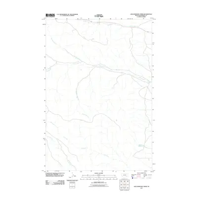
2011 Map of Hollowwood Creek
USGS Topo · Published 2011About this map
Hollowwood Creek and its many seasonal tributaries define the drainage patterns of this Rosebud County landscape. The terrain is marked by a complex system of drainages, including Woodenthigh Creek and Logging Creek, which converge as they move across the quadrangle. In the southern reaches of the map, the headwaters of Kelty Creek and Pawnee Creek indicate the varied topography of this rural Montana region. A localized water source, Bighead Reservoir, serves as a notable landmark in the southeastern quadrant. The presence of Patrick Spring further underscores the importance of reliable water points in this arid environment, where natural springs and small reservoirs were essential for ranching and land management in the early twenty-first century.
Find a feature on this map
8 named features on this map. Tap any name to fly to it.
Don’t see what you’re looking for? This feature index may not catch every label — zoom into the map to look around manually.
Map Details
Editions of this 2011 Hollowwood Creek Map
This is the sole edition of this map. No revisions or reprints were ever made.
Other maps of this area

1954 · Hardin
USGS Topo · 1:250,000

1957 · Hardin
USGS Topo · 1:250,000

1958 · Hardin
USGS Topo · 1:250,000

1958 · Garfield Peak
USGS Topo · 1:24,000

1958 · Fisher Butte
USGS Topo · 1:24,000

1958 · Badger Peak
USGS Topo · 1:24,000

1958 · Hollowwood Creek
USGS Topo · 1:24,000

1966 · Ashland
USGS Topo · 1:24,000

1966 · Birney Day School
USGS Topo · 1:24,000

1966 · Ashland NE
USGS Topo · 1:24,000