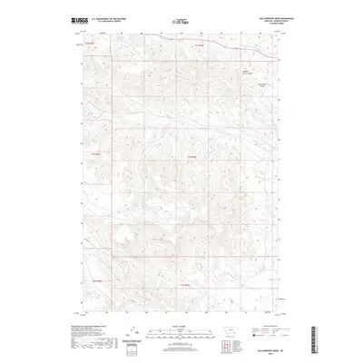
2020 Map of Hollowwood Creek
USGS Topo · Published 2020About this map
Hollowwood Cr flows through the heart of this Rosebud County landscape, defining a network of drainage systems that include Logging Cr and Crazy Head Fork. The area is characterized by a series of distinct coulees, such as Walking Horse Coulee and Little Coyote Coulee, which cut through the high-plains terrain. In the southern portion of the quadrangle, Bighead Reservoir provides a primary water source amidst the network of ephemeral and perennial streams. Transportation is facilitated by Birney Rd, which winds through the southern sections near Kelty Cr and Pewhee Cr. This modern 2020 survey documents the hydrologic pattern of the region, where isolated water features like Ratrick Spring and various named creeks illustrate the vital role of water management in the Big Sky state.
Find a feature on this map
18 named features on this map. Tap any name to fly to it.
Don’t see what you’re looking for? This feature index may not catch every label — zoom into the map to look around manually.
Map Details
Editions of this 2020 Hollowwood Creek Map
This is the sole edition of this map. No revisions or reprints were ever made.
Other maps of this area

1954 · Hardin
USGS Topo · 1:250,000

1957 · Hardin
USGS Topo · 1:250,000

1958 · Hardin
USGS Topo · 1:250,000

1958 · Garfield Peak
USGS Topo · 1:24,000

1958 · Fisher Butte
USGS Topo · 1:24,000

1958 · Badger Peak
USGS Topo · 1:24,000

1958 · Hollowwood Creek
USGS Topo · 1:24,000

1966 · Ashland
USGS Topo · 1:24,000

1966 · Birney Day School
USGS Topo · 1:24,000

1966 · Ashland NE
USGS Topo · 1:24,000