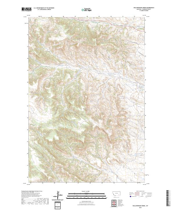
2024 Map of Hollowwood Creek
USGS Topo · Published 2024About this map
Hollowwood Creek and its complex drainage network define this high-elevation Montana landscape, showing the intricate land divisions and water sources critical to the region. The map highlights several distinct water features, from the flowing Stebbins Creek in the north to the Bighead Reservoir tucked in the southeastern corner. These names, including Crazy Head Fork and Woodenhigh Creek, reflect the local heritage and naming traditions of the area.
Find a feature on this map
18 named features on this map. Tap any name to fly to it.
Don’t see what you’re looking for? This feature index may not catch every label — zoom into the map to look around manually.
Map Details
Editions of this 2024 Hollowwood Creek Map
This is the sole edition of this map. No revisions or reprints were ever made.
Other maps of this area

1954 · Hardin
USGS Topo · 1:250,000

1957 · Hardin
USGS Topo · 1:250,000

1958 · Hardin
USGS Topo · 1:250,000

1958 · Garfield Peak
USGS Topo · 1:24,000

1958 · Fisher Butte
USGS Topo · 1:24,000

1958 · Badger Peak
USGS Topo · 1:24,000

1958 · Hollowwood Creek
USGS Topo · 1:24,000

1966 · Ashland
USGS Topo · 1:24,000

1966 · Birney Day School
USGS Topo · 1:24,000

1966 · Ashland NE
USGS Topo · 1:24,000