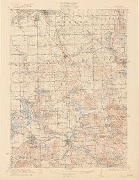
1922 Map of Holly
USGS Topo · Published 1922About this map
Flint and its southern agricultural hinterlands are captured here in the early 1920s, a landscape defined by an intricate network of country schools and glacial lakes. The region is heavily marked by the intersection of early automotive-era thoroughfares like United States Road and Detroit Road with the vital industrial arteries of the Grand Trunk and Pere Marquette railroads.
Find a feature on this map
157 named features on this map. Tap any name to fly to it.
Don’t see what you’re looking for? This feature index may not catch every label — zoom into the map to look around manually.
Map Details
Editions of this 1922 Holly Map
3 editions found
Other maps of this area

1907 · Pontiac
USGS Topo · 1:62,500

1907 · Howell
USGS Topo · 1:62,500

1909 · Howell
USGS Topo · 1:62,500

1909 · Milford
USGS Topo · 1:62,500

1919 · Burt
USGS Topo · 1:62,500

1920 · Flint
USGS Topo · 1:62,500

1920 · Holly
USGS Topo · 1:62,500

1921 · Burt
USGS Topo · 1:62,500

1922 · Holly
USGS Topo · 1:62,500

1922 · Durand
USGS Topo · 1:62,500