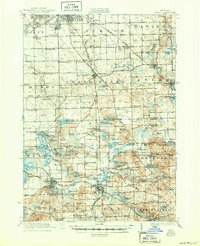
1922 Map of Holly
USGS Topo · Published 1950About this map
Holly and Fenton serve as primary rail hubs in this early 20th-century landscape, where the Pere Marquette Railroad and Grand Trunk Railway intersect. The industrial expansion of southern Flint is visible at the northern edge, while the surrounding townships maintain a dense network of rural infrastructure. The map records an era of transition in local transit, featuring the Detroit United Electric Railway corridor alongside traditional thoroughfares like Atherton Road and Bristol Road.
Find a feature on this map
165 named features on this map. Tap any name to fly to it.
Don’t see what you’re looking for? This feature index may not catch every label — zoom into the map to look around manually.
Map Details
Editions of this 1922 Holly Map
3 editions found
Other maps of this area

1907 · Pontiac
USGS Topo · 1:62,500

1907 · Howell
USGS Topo · 1:62,500

1909 · Howell
USGS Topo · 1:62,500

1909 · Milford
USGS Topo · 1:62,500

1919 · Burt
USGS Topo · 1:62,500

1920 · Flint
USGS Topo · 1:62,500

1920 · Holly
USGS Topo · 1:62,500

1921 · Burt
USGS Topo · 1:62,500

1922 · Holly
USGS Topo · 1:62,500

1922 · Durand
USGS Topo · 1:62,500