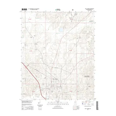
2015 Map of Holly Springs
USGS Topo · Published 2015About this map
Holly Springs serves as the focal point of this 2015 survey, illustrating a landscape defined by its educational and civil foundations. The campus of Rust Coll stands at the heart of the settlement, surrounded by numerous family and community landmarks such as Hillcrest Cem and Bishop Cottre Cem. The surrounding Marshall County countryside is characterized by the Coldwater River and the eastern reaches of the Holly Springs National Forest. Smaller outlying communities like Hudsonville and Atway are documented alongside a network of local roads including Martin Luther King Jr Dr and Salem Ave. This contemporary view provides a baseline for tracing the evolution of property and land use in northern Mississippi, from the established neighborhoods of Woodland Hts to the quiet rural corners near Higdon.
Find a feature on this map
86 named features on this map. Tap any name to fly to it.
Don’t see what you’re looking for? This feature index may not catch every label — zoom into the map to look around manually.
Map Details
Editions of this 2015 Holly Springs Map
This is the sole edition of this map. No revisions or reprints were ever made.
Other maps of this area

1944 · Tyro
USGS Topo · 1:62,500

1944 · Potts Camp
USGS Topo · 1:62,500

1945 · Potts Camp
USGS Topo · 1:62,500

1948 · Byhalia
USGS Topo · 1:62,500

1953 · Holly Springs
USGS Topo · 1:62,500

1956 · Tupelo
USGS Topo · 1:250,000

1958 · Tupelo
USGS Topo · 1:250,000

1964 · Waterford
USGS Topo · 1:24,000

1964 · Holly Springs SE
USGS Topo · 1:24,000
1965 · Slayden
USGS Topo · 1:24,000