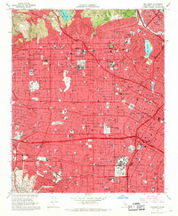
1966 Map of Hollywood
USGS Topo · Published 1968About this map
Griffith Park and the Santa Monica Mountains overlook a dense urban grid in this mid-1960s survey, capturing the golden age of the Los Angeles entertainment landscape. The map centers on the industrial and cultural landmarks of Hollywood, identifying the sprawling grounds of Paramount Studios and Columbia Pictures Studios. This era shows the city’s massive transportation infrastructure fully realized, with the Hollywood Freeway and Santa Monica Freeway cutting through neighborhoods like West Hollywood and Cienega.
Find a feature on this map
53 named features on this map. Tap any name to fly to it.
Don’t see what you’re looking for? This feature index may not catch every label — zoom into the map to look around manually.
Map Details
Editions of this 1966 Hollywood Map
4 editions found
Other maps of this area

1894 · Los Angeles
USGS Topo · 1:62,500

1896 · Pasadena
USGS Topo · 1:62,500

1896 · Redondo
USGS Topo · 1:62,500

1896 · Santa Monica
USGS Topo · 1:62,500

1896 · Downey
USGS Topo · 1:62,500

1898 · Santa Monica
USGS Topo · 1:62,500

1899 · Downey
USGS Topo · 1:62,500

1900 · Pasadena
USGS Topo · 1:62,500

1900 · Los Angeles
USGS Topo · 1:62,500

1901 · Southern California Sheet No. 1
USGS Topo · 1:250,000