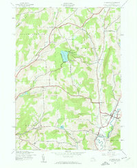
1943 Map of Holmesville
USGS Topo · Published 1960About this map
The Unadilla River valley serves as the primary corridor for settlement and transit along the eastern edge of Chenango County during the early 1940s. The Unadilla Valley railroad line parallels the river, connecting small agricultural hubs such as South New Berlin and Holmesville. This area is characterized by a network of upland farms and small crossroads communities like Kings Settlement and Amblerville, many of which grew around rural institutions including School No 2 and School No 7. Genealogy researchers will find several family-named landmarks and burial grounds, such as Bloom Cem and Wightman Cem, which anchor the landscape to the region’s early inhabitants. Between the river and the rolling hills of North Norwich, numerous water bodies like Chenango Lake and Whites Pond suggest a landscape used for both local industry and early recreation.
Find a feature on this map
39 named features on this map. Tap any name to fly to it.
Don’t see what you’re looking for? This feature index may not catch every label — zoom into the map to look around manually.
Map Details
Editions of this 1943 Holmesville Map
4 editions found

Other maps of this area

1902 · Coventry
USGS Topo · 1:62,500

1903 · Norwich
USGS Topo · 1:62,500

1904 · Oxford
USGS Topo · 1:62,500

1910 · New Berlin
USGS Topo · 1:62,500

1912 · New Berlin
USGS Topo · 1:62,500

1915 · Unadilla
USGS Topo · 1:62,500

1918 · Unadilla
USGS Topo · 1:62,500

1943 · New Berlin North
USGS Topo · 1:24,000

1943 · New Berlin South
USGS Topo · 1:24,000

1943 · Gilbertsville
USGS Topo · 1:24,000