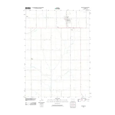
2010 Map of Holstein
USGS Topo · Published 2010About this map
Holstein dominates the northern landscape of this Ida County survey, positioned at the intersection of local routes like S Kiel St and German Ave. The settlement’s infrastructure is anchored by the Holstein Post Office, while the surrounding prairie is defined by a rigorous section-line road grid including Dodge Ave and Eagle Ave. This agricultural territory is drained by an intricate network of waterways, most notably Battle Creek and its branches, the West Fork Battle Creek and East Fork Battle Creek. Genealogy researchers will find several significant burial sites across the township, such as the Norwegian Cemetery to the northwest, the OLGC Cemetery just south of town, and the Battle Township Cemetery further afield. These landmarks, alongside smaller tributaries like Ashton Creek and Bacon Creek, illustrate the enduring rural character of this western Iowa region.
Find a feature on this map
26 named features on this map. Tap any name to fly to it.
Don’t see what you’re looking for? This feature index may not catch every label — zoom into the map to look around manually.
Map Details
Editions of this 2010 Holstein Map
This is the sole edition of this map. No revisions or reprints were ever made.
Other maps of this area

1954 · Fort Dodge
USGS Topo · 1:250,000

1957 · Fort Dodge
USGS Topo · 1:250,000

1958 · Fort Dodge
USGS Topo · 1:250,000

1967 · Holstein
USGS Topo · 1:24,000

1967 · Ida Grove
USGS Topo · 1:24,000

1967 · Battle Creek
USGS Topo · 1:24,000

1967 · Ida Grove NW
USGS Topo · 1:24,000

1969 · Holstein SW
USGS Topo · 1:24,000

1969 · Galva
USGS Topo · 1:24,000

1969 · Cushing
USGS Topo · 1:24,000