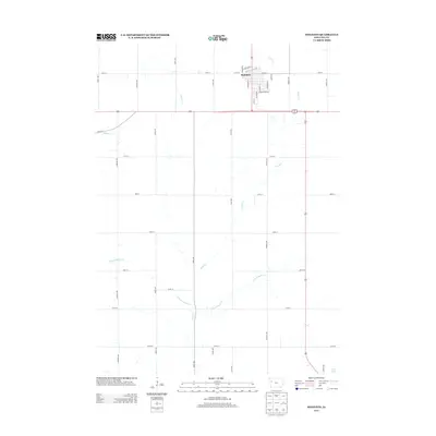
2013 Map of Holstein
USGS Topo · Published 2013About this map
The town of Holstein serves as the primary hub of this Ida County landscape, where the grid of the northern plains meets the branching drainage systems of the Missouri River watershed. A legacy of German settlement is evident in the street names of the town, including S Hamburg St, S Kiel St, Lubeck St, and German Ave, reflecting the cultural heritage of the early homesteading families. The surrounding rural acreage is defined by a strictly organized road network of avenues and numbered streets like 150th St and Carriage Ave, which frame the meandering paths of Silver Creek and the various branches of Battle Creek. In the southeastern corner, the small impoundment of Grell Pond provides a rare point of standing water amidst a terrain primarily dedicated to intensive agricultural production and the transport corridors of the early 21st century.
Find a feature on this map
39 named features on this map. Tap any name to fly to it.
Don’t see what you’re looking for? This feature index may not catch every label — zoom into the map to look around manually.
Map Details
Editions of this 2013 Holstein Map
This is the sole edition of this map. No revisions or reprints were ever made.
Other maps of this area

1954 · Fort Dodge
USGS Topo · 1:250,000

1957 · Fort Dodge
USGS Topo · 1:250,000

1958 · Fort Dodge
USGS Topo · 1:250,000

1967 · Holstein
USGS Topo · 1:24,000

1967 · Ida Grove
USGS Topo · 1:24,000

1967 · Battle Creek
USGS Topo · 1:24,000

1967 · Ida Grove NW
USGS Topo · 1:24,000

1969 · Holstein SW
USGS Topo · 1:24,000

1969 · Galva
USGS Topo · 1:24,000

1969 · Cushing
USGS Topo · 1:24,000