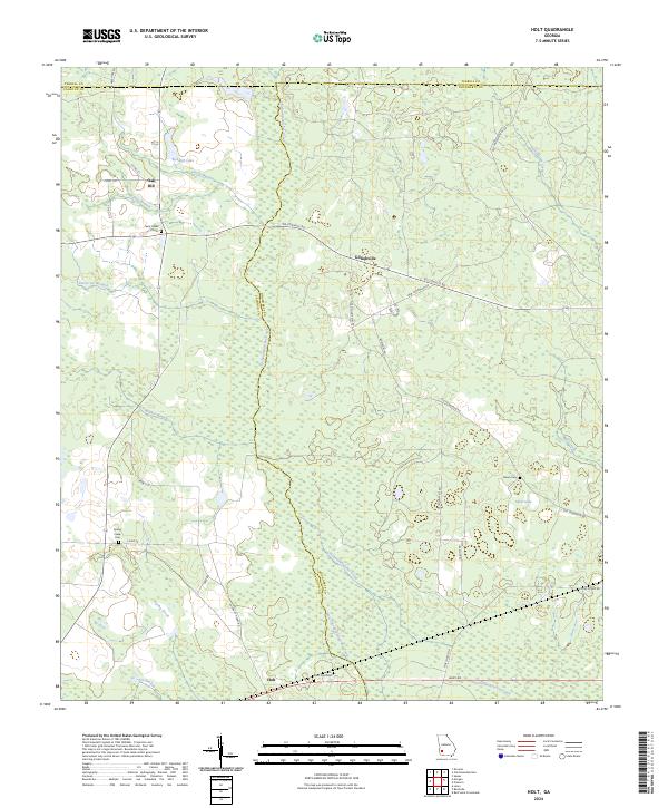
2024 Map of Holt
USGS Topo · Published 2024About this map
Chickasawhatchee Creek defines the central corridor of this Southwest Georgia landscape, winding south through a dense network of wetlands where Terrell, Calhoun, and Dougherty counties meet. The settlement patterns are rooted in agriculture and community life, anchored by small clusters like Gillionville and Holt. Family and community history are preserved in several distinct burial grounds scattered across the terrain, including Saint Paul Cem near the southern boundary and Saint Lukes Cem to the northwest. The presence of the Old Tallassee Trail Rd suggests deep historical routes through this river-fed region. Water is a constant theme, from the broad Suddeth Lake in the north to the numerous branches like Vincey Branch and Horse Lot Branch that feed the main creek system. This map captures the contemporary layout of these rural townships as they appeared in 2024.
Find a feature on this map
39 named features on this map. Tap any name to fly to it.
Don’t see what you’re looking for? This feature index may not catch every label — zoom into the map to look around manually.
Map Details
Editions of this 2024 Holt Map
This is the sole edition of this map. No revisions or reprints were ever made.
Other maps of this area

1953 · Dothan
USGS Topo · 1:250,000

1954 · Dothan
USGS Topo · 1:250,000

1955 · Dothan
USGS Topo · 1:250,000

1956 · Newton
USGS Topo · 1:62,500

1956 · Sasser
USGS Topo · 1:62,500

1973 · Morgan
USGS Topo · 1:24,000

1973 · Chickasawhatchee
USGS Topo · 1:24,000

1973 · Sasser
USGS Topo · 1:24,000

1973 · Pretoria
USGS Topo · 1:24,000
1973 · Holt
USGS Topo · 1:24,000