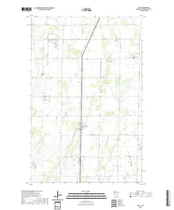
2022 Map of Holt
USGS Topo · Published 2022About this map
Holt serves as the primary settlement on this Northwest Minnesota landscape, situated at the intersection of Lincoln Ave and 1st St. The town's presence is anchored by the Holt Cem, while the surrounding countryside preserves the names of smaller community burial grounds such as Ringbo Cem to the northeast and Folden Cem to the northwest. These sites offer critical touchpoints for genealogists tracing family roots in Marshall County.
Find a feature on this map
29 named features on this map. Tap any name to fly to it.
Don’t see what you’re looking for? This feature index may not catch every label — zoom into the map to look around manually.
Map Details
Editions of this 2022 Holt Map
This is the sole edition of this map. No revisions or reprints were ever made.
Other maps of this area

1918 · Viking
USGS Topo · 1:62,500

1918 · Middle River
USGS Topo · 1:62,500

1943 · Thief River Falls
USGS Topo · 1:62,500

1952 · Thief River Falls
USGS Topo · 1:250,000

1956 · Thief River Falls
USGS Topo · 1:250,000

1957 · Thief River Falls
USGS Topo · 1:250,000

1957 · Newfolden
USGS Topo · 1:62,500

1959 · Rosewood
USGS Topo · 1:24,000
1961 · Thief River Falls NE
USGS Topo · 1:24,000
1961 · Middle River NE
USGS Topo · 1:24,000