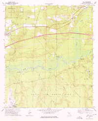
1973 Map of Holt
USGS Topo · Published 1976About this map
Louisville and Nashville tracks define the upper corridor of this landscape, connecting the rural communities of Holt, Galliver, and Milligan in the years before the modern interstate era. The northern territory is largely occupied by the Blackwater River State Forest, while the southern half transitions into the restricted grounds of Eglin Air Force Base, featuring Aux Field No 6. Between these vast managed lands, the Yellow River and Shoal River meander through a series of bluffs and landings.
Find a feature on this map
39 named features on this map. Tap any name to fly to it.
Don’t see what you’re looking for? This feature index may not catch every label — zoom into the map to look around manually.
Map Details
Editions of this 1973 Holt Map
2 editions found
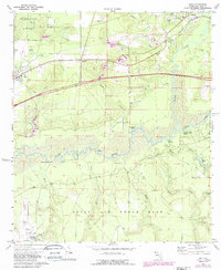
Other maps of this area

1934 · Holt
USGS Topo · 1:48,000

1934 · Harold
USGS Topo · 1:62,500

1937 · Holt
USGS Topo · 1:62,500

1937 · Harold
USGS Topo · 1:62,500

1938 · Harold
USGS Topo · 1:62,500

1948 · Munson
USGS Topo · 1:62,500

1949 · Crestview
USGS Topo · 1:62,500

1950 · Munson
USGS Topo · 1:62,500

1951 · Crestview
USGS Topo · 1:62,500

1956 · Holt
USGS Topo · 1:62,500